1855
Beginnings of the Neighborhood:
The Changing Boundaries of the Street
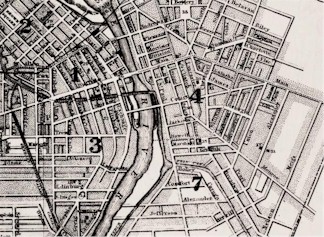
The street began life in 1811, when surveyors cleared a highway from the Orringh Stone tavern (now known as the Stone-Tolan House) in the Brighton area towards the waterfall on the Genesee River. It soon became a major route for stagecoaches into the city. Farms, taverns and stagecoach stops were the primary features of the highway. The name "East Avenue" was not used until around 1845, when an early resident, Josiah Bissell tacked up signs using the name "East Avenue", even though his official request to the Common Council to change the name of the street had been rejected. The name was later officially changed, however, because the name "East Avenue" appears in city directories beginning in 1855.
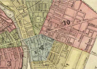
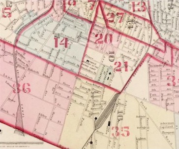
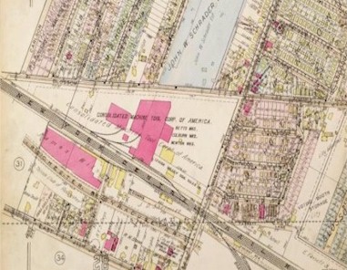
Previously the road had been part of Main Street. It originally extended from the Liberty Pole to Goodman Street, the eastern boundary of the city in 1834. This boundary changed several times. In 1874 the section in Brighton from Goodman to Culver Road was annexed by the city. Again in 1905, East Avenue expanded when the business district of the Village of Brighton itself (located then at East Avenue and Winton Road) was annexed because residents of that area wanted access to sewers and water mains under the city's jurisdiction.
|
| 1849 |
|
1855 |
|
|
| 1875 |
|
|
| 1926 |
|Introduction| |Next |
Send comments to Webmaster
Copyright Monroe County (NY) Library System
115 South Ave., Rochester, NY 14604